DEMO UNITS AVAILABLE · +63 917 870 3551
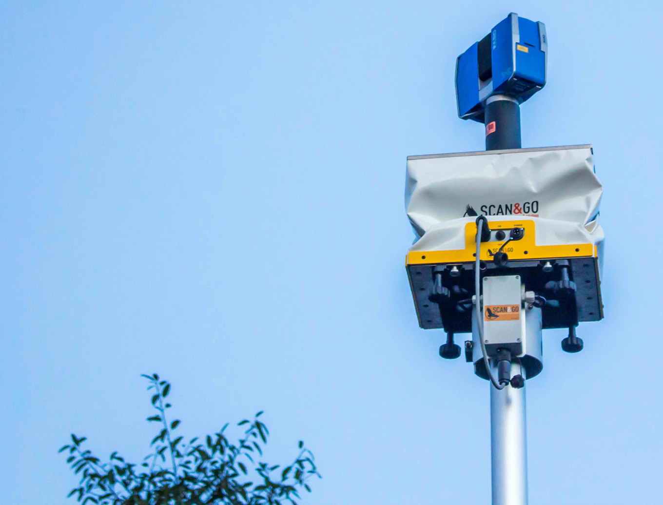
RASA Scan&Go mobile mapping system
Four companies · One quote desk

Survey gear, drones, and the crew who actually use them.

We sell the instrument, calibrate it, train your team on it — and if you'd rather we just did the survey, we do that too. Same building since 1994.

Browse the catalogue Contract a survey instead
AUTHORISED Hi-Target · Easymap UAV IMAGERY DigitalGlobe · Supergeo SINCE 1994
What do you actually need?60 SEC
What's the job?
What accuracy has to hold?
Buying, renting, or hiring us?
Recommendation

—

—

Job type—
Accuracy class—
Intent—
ROUTED TO—
Get my quote
All equipmentGNSS / RTKTotal stations Laser scannersDrones & payloadsAccessoriesSoftware
Catalogue

Every instrument, with the spec that matters.

Prices shown on request — but the specification, the accuracy class and the stock position are public. That is the difference between a catalogue and a Facebook album.

Download full price list ↓
AllGNSS / RTKTotal stationsLaser scanners DronesLiDAR payloadsIn stockDemo available
How we quote

The enquiry that doesn't go cold.

Right now an enquiry lands on Facebook Messenger and sits there. Nobody knows if it's a government engineer with a budget or a student doing a thesis. This is the fix.

STEP 01

They self-qualify

Three questions on the way in. Job type, accuracy class, buying intent — answered before anyone on your team spends a minute.

STEP 02

The lead is scored

Government topo job needing cm-accuracy and buying now scores higher than an unsure researcher. Both get a reply. Only one gets a call today.

STEP 03

Routed to the right desk

Equipment goes to Instruments. A whole survey goes to Services. A drone job goes to Drone Vision Pro. No more forwarding screenshots.

STEP 04

Nothing goes cold

Every enquiry sits in one list with an owner and an age. The follow-up problem becomes a visible number instead of a feeling.

Or don't buy anything

Hire the crew that wrote the spec.

Most Philippine dealers only sell. We run a 30-year survey practice with the same instruments — so the advice is field-tested, not brochure-deep.

Services

Contract the survey

Land, engineering, construction, hydrographic and parcellary survey nationwide. Signed plans, defensible tolerances.

Aerial

Book the drone

UAV LiDAR and photogrammetry with the RIEGL miniVUX-1UAV. Corridor, canopy and volumetric capture.

Support

Calibration & training

Instrument calibration, operator training and after-sales support — including for gear you didn't buy from us.

Tell us the job. We'll tell you the instrument.

Or quote the whole survey. Reply within one business day, from a person who has been on site.

Start the 60-second checkTalk to an engineer
← All concepts04 · The Exchange
010203040506 CONCEPT PROTOTYPE